


The IATA and RAeS Contrail Workshop Rewind
Key Insights and Takeaways from Day 2 of the Conference

After an informationally intense first day of sessions, the second day focused on application. Having established an understanding of contrail formation and the feasibility of contrail avoidance, speakers next explored the many methods and measures available for mitigation and management, while keeping an open mind to all potential solutions.
Day 2 – Impact of SAF, Flight Rerouting, Contrail Observation, and Regional Forecasts
Fuel composition is proving to be a critical component not only for solving aviation decarbonization, but also to limiting the generation of persistent contrails. Speakers discussed in great detail the latest research and trials regarding the use of sustainable aviation fuel (SAF) and other low-aromatic fuels. The introduction of SAF would complement flight rerouting measures already being trialed and introduced by certain airlines to avoid regions most likely to create contrails. While SAF and these “eco-efficient” flight trajectories appear to be the perfect match, experts stressed more observational data and validation are necessary to improve the accuracy of forecasting predictions for flights utilizing both.
SAF Contrail Impact
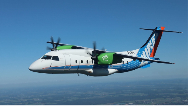
To explore how SAF could affect aviation emissions and contrail formation, representatives from DLR (German Aerospace Center), NASA (U.S. Aerospace Association), ONERA (French Aerospace Lab), and Imperial College London presented the findings of their respective trials and studies. Each organization offered a unique perspective, often with breakthrough testing campaigns which have set the standard for future research.
DLR, for example, has participated in various trials measuring the impacts of SAF both on the ground and in flight. Recent years have seen work on the ECLIF and VOLCAN projects, but their discussion mainly highlighted the LUFO Uplift CLIM0ART campaign. Here, they focused on the emissions of turboprop aircraft with 100% e-fuel (PtL proxy). The results of this first-of-its-kind trial are promising, as the research team found a reduction of particle emissions on the ground and a decrease in contrail formation. Perhaps most importantly, the trial has boldly set the stage for future work.
Similarly, NASA, has been taking its research to the skies with the Boeing ecoDemonstrator. Their ground-based and in-flight measurements using pure SAF and lean-burn engines have assessed the best particle and contrail reductions currently possible. More recently, they partnered with GE Aerospace and DLR on the CODEX project, designed to quantify contrail optical depth and evaluate contrail model predictions using the novel High Altitude Lidar Observation (HALO) lidar. There’s much to be gleaned from these trial flights, but let’s focus on some of the key results mentioned in the presentation:
Lean-burn engines (LEAP 1B) burning 100% HEFA-SAF saw a 1000x reduction in soot number emissions compared to rich-burn engines burning Jet A1.
Contrail ice number was reduced by about 2x – 10x.
The HALO lidar enabled the quantification of contrail optical thickness and water vapor profiles.
Fine performance of new water vapor sensors is inspiring further small sensor development.
What is lidar? LIDAR, meaning Light Detection and Ranging, is a technology which uses lasers to create 3D models of the Earth’s surface.
Finally, ONERA, having worked with DLR on the VOLCAN flights, targeted their expertise towards the observation of contrail formation to better model and improve contrail prediction. With the use of both test flights and satellites, they can hone in on the role of particles in contrail development. This was complemented by Imperial’s research into the role of volatile particulate matter (vPM) on contrail climate effects. They described how vPM can activate to form contrail ice crystals at low temperatures, yet existing simulations do not account for vPM activation which could lead to an underestimation of contrail warming effects. They concluded more measurements are needed to confirm their findings and understand the relationship between vPM and contrails and how SAF and cleaner-burning engines can contribute to mitigation.
Rerouting Flight Trajectories
The next session, though brief, examined a subject which could be critical to the immediate integration of contrail avoidance at scale. This legendary method involves using weather forecasts to route and reroute flights away from regions most likely to cause persistent contrails. The presentation focused on the DLR-led D-KULT project developed for “climate-optimized aircraft trajectories”.

The project is developing accurate and reliable weather data because it is the bedrock necessary to design new flight operation tools and the trials necessary test weather data and flight tools. The integration of the chain above will require cross-sector collaboration to streamline the flow of information and ensure accuracy and efficacy in dealing with the scale of data. Each link will have its part to play. Here’s a quick snapshot from their presentation of each link’s role (from left to right on the chain):
Deutscher Wetterdienst (DWD) – developed an experimental Numerical Weather Prediction (NWP) with climate-relevant parameters for improved forecasting of relative humidity over ice in D-KULT.
DLR – harnessing climate change functions to predict which regions have high or low climate effects.
Lufthansa Systems – building flight route optimizations to minimize fuel, time, and environmental costs as well as overflight charges and generate eco-efficient trajectories.
PACE Aerospace – providing pre-flight and in-flight route optimization for regions of Potential Persistent Contrail (PPC) formation.
Lufthansa, Lufthansa Cargo, Condor, and DHL – participated in the German 100-flights trial to test prototype data and tools.
Deutsche Flugsicherung (DFS) – reviewed the impact on air traffic control (ATC) after the trial, confirming the operational concept of avoiding PPC-areas with these limitations:
Avoiding PPC-areas creates a higher workload for flight controllers.
Controller capacity and workload depends on the size and location of a PPC-area.
This raises serious safety concerns which DFS has noted and will assess.
For these reasons, an overall strategy for ATC is necessary to scale beyond individual flights.
The final evaluation is still ongoing, but the project’s achievements display the promise of contrail avoidance through route optimization. With improved understanding of contrail climate impacts, further evaluation of the remaining uncertainties (risk), and the synthesis of the results into future operating systems, the critical final step would be integrating these measures on an international scale.
Contrail Observation and Validation
Contrail observation is vital to propel the contrail management initiative and to fine-tune the models used in forecasting and prediction. That doesn’t mean just standing out in the backyard staring at the sky – though we must admit we do enjoy that means of observation. The scientific community’s observation methods are much more nuanced. These involve satellite tracking, high-fidelity datasets, ground-based cameras, AI detection models, and aircraft sensors (as well as some good old-fashioned sky gazing and picture taking, translated into useful data by the Contrails Observer app).
This conference session focused on refining observation methods. Researchers from TU Delft, Imperial College London, Google, the regulatory authority EUROCONTROL, and the World Meteorological Organization (WMO) presented on the rapid progress being made to make observations more accurate and sophisticated. So, let’s dive into some of the details.

Satellite observation was the heart of TU Delft’s presentation, as they extolled the benefits of using this imaging to assess the accuracy of contrail models. Whether geostationary satellites, which match the earth’s orbit at specific altitudes to provide coverage of a large area, or low-earth orbit satellites, which orbit at lower altitudes with high-resolution scanners providing passive imagery, satellites offer a unique vantage point for contrail tracking. Imperial reiterated this and presented the details of each different method of observation. They also showed how a multi-source approach would be optimal for accurate readings and building a robust dataset encompassing contrail formation, evolution, altitude information, and physical properties.
Though vital, tracking and tracing the countless contrails around the globe is quite labor intensive, so Google has been working to develop an AI which can identify contrails through satellite images. They have already put this algorithm to the test (alongside American Airlines and Breakthrough Energy) by practicing contrail avoidance with AI-based prediction models, verifying the accuracy of AI detection, and demonstrating the number of contrails created by commercial flights can be reduced.
This work complements the efforts of the CICONIA project, as presented by EUROCONTROL. The project aims to validate and optimize prediction models, evaluate monitoring systems for avoidance strategies, and quantify uncertainties to understand the limits of what can be simulated. All of this through various observational methodologies. As showcased in the presentation, the project used GOES-16 (a geostationary satellite), ground-based tracking, and a deep-learning approach to track contrails across their lifetimes. This approach enabled the team to match the contrails to the flights which created them and confirm the consistency of contrail tracking. EUROCONTROL believes the results can substantiate the efficacy of automated tracking through satellite imagery and AI-based detection.
Finally, the WMO wrapped up the session by expounding on their role in contrail avoidance and the importance of aircraft-based observations (ABO). Yet another method of observation, and one which could prove to be the final piece of the puzzle, is to place humidity sensors on aircraft to gauge relative humidity and air temperature. These measurements could identify ISSRs where persistent contrails are likely to form and alert other aircraft to take avoidance measures such as flight rerouting mentioned earlier. Programs such as the In-service Aircraft for a Global Observing System (IAGOS) and FLYHT are equipping aircraft with sensors to measure water vapor and scan the skies for ISSRs. WMO closed the session with a call for collaboration, a theme across the event, exemplified by the final session of the workshop.
Forecasting Fertile Regions for Contrail Cirrus Formation
Almost there. The last segment of the day’s presentations came from DWD and Météo France – the German and French meteorological administrations respectively. Both entities took a technical approach to forecasting ISSRs and confronting some of the challenges that impede consistently accurate predictions.
DWD opened by drilling down on the task of improving NWP models to deal with supersaturation and relative humidity over ice (RHi). By improving the model physics, they believe forecast accuracy can be increased. They emphasize the need to balance weather prediction with aircraft humidity sensors for en-route measurements – methods which are typified by active projects:
BeCoM – (short for “Better Contrail Mitigation”) is working to improve NWP models with the goal of >50% reduction or elimination of the global mean contrail radiative forcing.
MEFKON – is improving the use and accuracy of aircraft sensors for humidity forecasting.
D-KULT – is testing for climate-optimized trajectories to demonstrate climate and environmentally friendly aviation.
Since, the quality of prediction models depend on the quality input data, DWD is working to ensure the European Commission’s MET data input parameters for its MRV framework are consistent and accessible. This is another step toward validating climate response models and developing a forecasting system that can be reliably used at scale for contrail avoidance.
To bring it all together, Météo France presented a case study testing the accuracy of predicting RHi and the subsequent presence of ISSRs by comparing prediction models on a flight route from Frankfurt to Washington D.C. By combining different forms of measurement (i.e., NWP data from ARPEGE and temperature and humidity observations from IAGOS) and overlaying those measurements, they developed a forecast of the ISSRs along the flight’s trajectory and verified the accuracy of the forecast with satellite imagery. The final publication of the results is still pending, but they concluded (in brief) that the models used show ISSR discrimination capabilities as well as challenges in representing the highest RHi values.
Perhaps the area of most uncertainty in the realm of contrail management, weather forecasting and the prediction of ISSRs, deserves the attention that it received in London. With continued efforts from these meteorological agencies and the organizations and projects dedicated to improving prediction models, justifiable reliability on weather forecasting will increase and contrail avoidance strategies can begin in full swing.
In Closing
The IATA and RAeS meeting held on March 10-11, 2025, brought together key stakeholders in the aviation industry to discuss pressing challenges and future advancements in the field of contrail management. Key topics included understanding the science of contrails, advancements in avoidance measures, and innovations in weather forecasting for contrail prediction. The discussions emphasized the need for industry-wide collaboration to improve operational efficiencies, enhance observation measures, and ultimately achieve the ambitious goal of mitigating the climate impact of contrails.
Looking ahead, the meeting reinforced the importance of continued investment in research and development to drive technological breakthroughs and support the industry's long-term sustainability goals. Participants acknowledged the evolving landscape of global aviation and the existent challenges and uncertainties within contrail management. The discussions also highlighted the significance of workforce training and development to equip aviation professionals with the skills required for an increasingly digital and automated industry. By fostering collaboration and maintaining a forward-thinking approach, the industry can navigate challenges while ensuring a resilient and sustainable future for global air travel.